Accumulating snow and the threat of freezing rain, followed by a potentially significant rainfall has triggered both a weather advisory and a rainfall warning for Sault Ste. Marie and surrounding areas.
Environment Canada says north of the Sault, snow with a risk of freezing rain is likely later tonight into Wednesday.
"Confidence in snowfall amounts is low as the temperature will be close to the freezing mark, although some areas may receive up to 10 cm," the weather advisory stated.
"Note that for areas closer to Sault Ste Marie and especially St. Joseph Island, precipitation is expected to mainly be rain, with significant amounts possible."
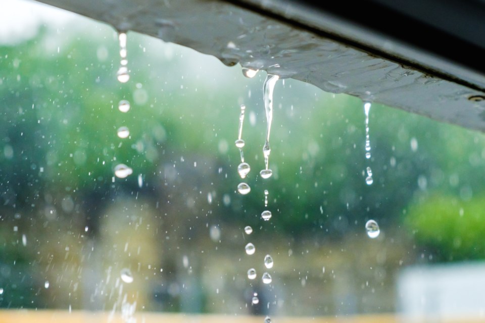
That is why there is a rainfall warning in effect, which says a low pressure system could bring 20 to 35 mm.
That is expected to combine with melting snow, and the warning says the frozen ground will reduce its ability to absorb all that water.
Localized flooding in low-lying areas is possible, along with possible washouts near rivers, creeks and culverts.
"Rain will likely transition to snow with a risk of freezing rain Wednesday night or Thursday morning," Environment Canada said.
Find the full news releases from Environment Canada below:
Rainfall warning issued for:
Sault Ste. Marie - St. Joseph Island, Ont. (048830)
West Nipissing - French River, Ont. (049810)
Rainfall warning continued for:
Manitoulin - Blind River - Killarney, Ont. (049900)
Current details:
Rainfall, combined with melting snow, is expected. The frozen ground has a reduced ability to absorb this rainfall.
What:
Total rainfall amounts of 20 to 35 mm.
When:
This evening through Wednesday morning.
Where:
Manitoulin Island as well as areas near North Channel and Georgian Bay.
Additional information:
Light precipitation today will become more widespread tonight as a low pressure system approaches the area. Significant amounts of rain are possible. Rain will likely transition to snow with a risk of freezing rain Wednesday night or Thursday morning.
For information concerning flooding, please consult your local Conservation Authority or Ontario Ministry of Natural Resources office. Visit Ontario.ca/floods for the latest details.
Localized flooding in low-lying areas is possible.
************************
Weather advisory issued for:
Sault Ste. Marie - St. Joseph Island, Ont. (048830)
Current details:
Accumulating snow and threat of freezing rain, mainly north of Sault Ste. Marie.
What:
Snowfall amounts of 5 to 10 cm.
Risk of freezing rain leading to icy and slippery conditions.
When:
Later tonight through Wednesday.
Additional information:
For areas mainly north of Sault Ste. Marie, snow with a risk of freezing rain is likely later tonight into Wednesday. Confidence in snowfall amounts is low as the temperature will be close to the freezing mark, although some areas may receive up to 10 cm.
Note that for areas closer to Sault Ste Marie and especially St. Joseph Island, precipitation is expected to mainly be rain, with significant amounts possible. Refer to the rainfall warning that is in effect for more details.
All areas should switch over to snow with a risk of freezing rain later Wednesday as colder air moves into the region.
Motorists should expect hazardous winter driving conditions and adjust travel plans accordingly.
Be prepared to adjust your driving with changing road conditions. Slow down driving in slippery conditions. Watch for taillights ahead and maintain a safe following distance.
For road conditions and other traveller information from the Ministry of Transportation, visit https://www.ontario.ca/511, https://www.twitter.com/511Ontario, or call 5-1-1.
Please continue to monitor alerts and forecasts issued by Environment Canada. To report severe weather, send an email to [email protected] or post reports on X using #ONStorm.
More details on the alert are available here.