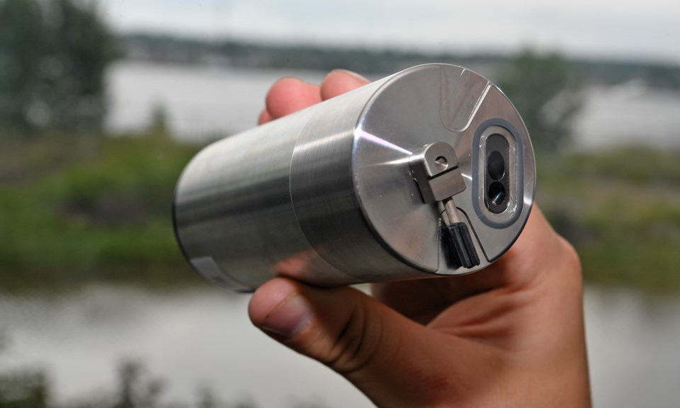
The call went out after a 5,300-gallon (20,062 litre) oil spill on June 9 at Algoma Steel. Responders needed an almost instantaneous awareness of how well containment and clean-up efforts were going.
The conventional way of tracking still entails a “boots on the ground” approach of manual sampling along the shore or from a boat.
Was there anyone with an automatic, continuous way of monitoring?
As it happened, Lake Superior State University’s Center for Freshwater Research and Education (CFRE) was evaluating oil-detection sensors that sell for a fraction of the cost of conventional ones.
So, along with LimnoTech, a company that markets the sensors, within a day after the call went out, CFRE technicians placed three along the north shore of Sugar Island and one further downstream in Lake Muncoscong.
The good news is that none of the sensors detected oil in their area after the spill, and as of the end of July, continue not to see hydrocarbon signatures of anything that would linger.
The sensors report measurements every 10 minutes via a cell network. And they will continue to do so for at least the next year, according to CFRE director Ashley Moerke.
“The spill allowed us to get these in the field quickly to see if the oil was measurably widespread,” she said. “The fact that we did this quickly and that they continue to work well validates this approach.”
The sensors work on the same principle as that 1970s artform, the blacklight painting - shine a deep purple light onto a painting and dig the glow. However, these sensors use the deepest purple there is - ultraviolet light - that make telltale molecular hydrocarbon chains in oil glow if they are present. If the sensor sees a glow, then there’s oil.
“That’s basically what they do now,” said Moerke. “What we are continuing to study is how well they hold up to the elements and how easy they are to maintain. Eventually the tests we do in-house, in lab tanks here, will further measure how these inexpensive sensors work and the consistency of their data, in any orientation.”
It is the low cost of the technology that gets Moerke excited.
“We could see hundreds of sensors like this along the full length of the river, reporting back on not only signs of oil but that of any other pollution,” Moerke said. “Continuous measurements of turbidity, current, and temperature will let us model the river with great precision. All the data will be online for the public to see, like we now see with weather stations.”
So rather than snapshots, we see a river’s heartbeat.
Oil spill field tests also validated hardware and software needed to get measurements from the oil sensors to the people who needed it most.
CFRE technician Drew Heckman used open-source computer code to get the oil sensor to talk with a mother board that stores the data and sends it wirelessly in bursts, or packets, every 10 minutes.
“The challenge was to get everything talking and phoning in regularly,” said Heckman. “The architecture for this will support other sensors that monitor water temperature, ions, turbidity . . . anything there is to measure.”
Stations will be placed along the river with sensors plugged in as needed, depending on what researchers want to study.
Oil sensors are a permanent feature on the St. Marys. Their number will likely go up. Next month the U.S. Coast Guard National Center of Expertise opens in the CFRE building. Its specialty will be to refine techniques on how to deal with oil and chemical spills on the Great Lakes.
Finding them quickly is the first step.
