THUNDER BAY – Ice formation on Lake Superior is occurring at a rate that's slightly faster than normal.
With recent temperatures in the region significantly below what's typical for this time of year, it comes as no surprise to people who monitor lake conditions.
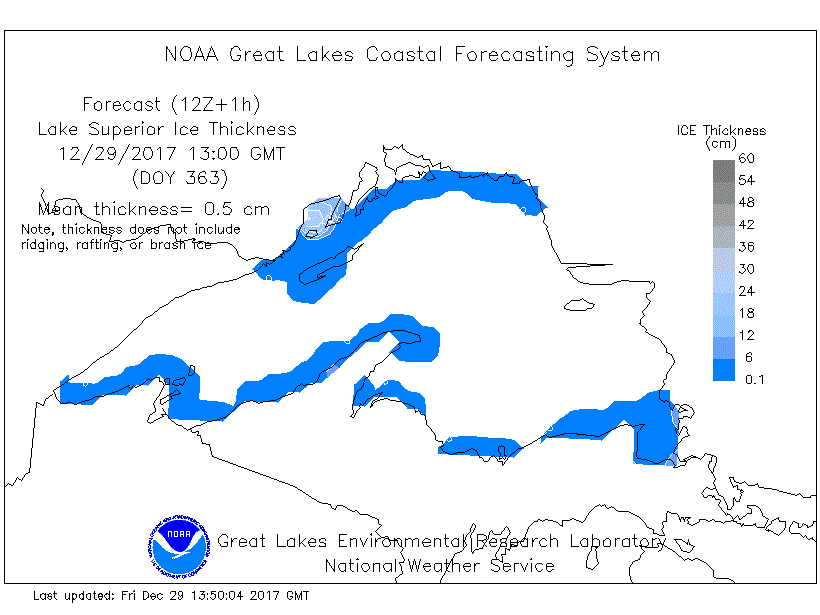
As of Thursday, about seven per cent of Lake Superior was ice-covered.
George Leskovich, a scientist at the Great Lakes Environmental Research Laboratory in Ann Arbor, Mich., says that since 1973, the average ice coverage on Superior at this time of year has been just under five per cent.
Earlier in December, he said, ice formation had been following the historical pattern, but recently it's "shot up a little bit."
Leskovich said satellite imagery shows the most extensive coverage includes areas along the northern part of Superior such as Thunder Bay, Black Bay and Nipigon Bay as well as Whitefish Bay, Duluth and parts of the southern coastline.
It's projected that the coverage will grow to just over nine per cent by Jan. 3.
In an interview Friday with tbnewswatch.com, Leskovich said the U.S. National Oceanic and Atmospheric Administration (NOAA) believes an enhanced La Nina, which features cooler than normal ocean water temperatures near the Equator in the Pacific Ocean, will bring below-normal temperatures to the region this winter.
He said if NOAA's air-temperature predictions for January are correct, he would "guess that there would be significant ice cover...owing to those cold temperatures."
Leskovich cautioned, however, that "that is quite far out to predict," noting that both the Canadian Ice Service and the National Ice Center in the U.S. are expecting ice cover similar to the past two years.
The current average water temperature in Lake Superior is 3.25 degrees Celsius, A year ago at this time it was 3.9 degrees.
