WEATHER BULLETIIN
ENVIRONMENT CANADA
Severe thunderstorm warning for Searchmont - Montreal River Harbour - Batchawana Bay ended

Alert will be updated or ended by 1:30 a.m. EDT.
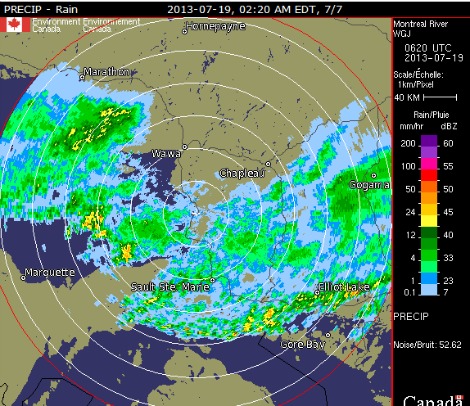
At 11:20 p.m. EDT, meteorologists are tracking areas of strong to severe thunderstorms, one extending from New Liskeard to northern Lake Huron and another over Superior East both moving east southeast at 60 km/h.
Some of the thunderstorms are capable of producing hail greater than 2 cm in diameter and damaging winds to 90 km/h.
Locally heavy downpours are also a threat.
An isolated tornado is also possible.
Updated or ended by 12:30 a.m. EDT.
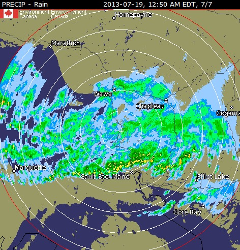
Severe thunderstorm warning for: Sault Ste. Marie - St. Joseph Island- Searchmont - Montreal River Harbour - Batchawana Bay continued
Emergency Management Ontario recommends that you take cover immediately, if threatening weather approaches.
Strong wind gusts and hail can damage property and cause injuries. Local downpours can cause flash floods.
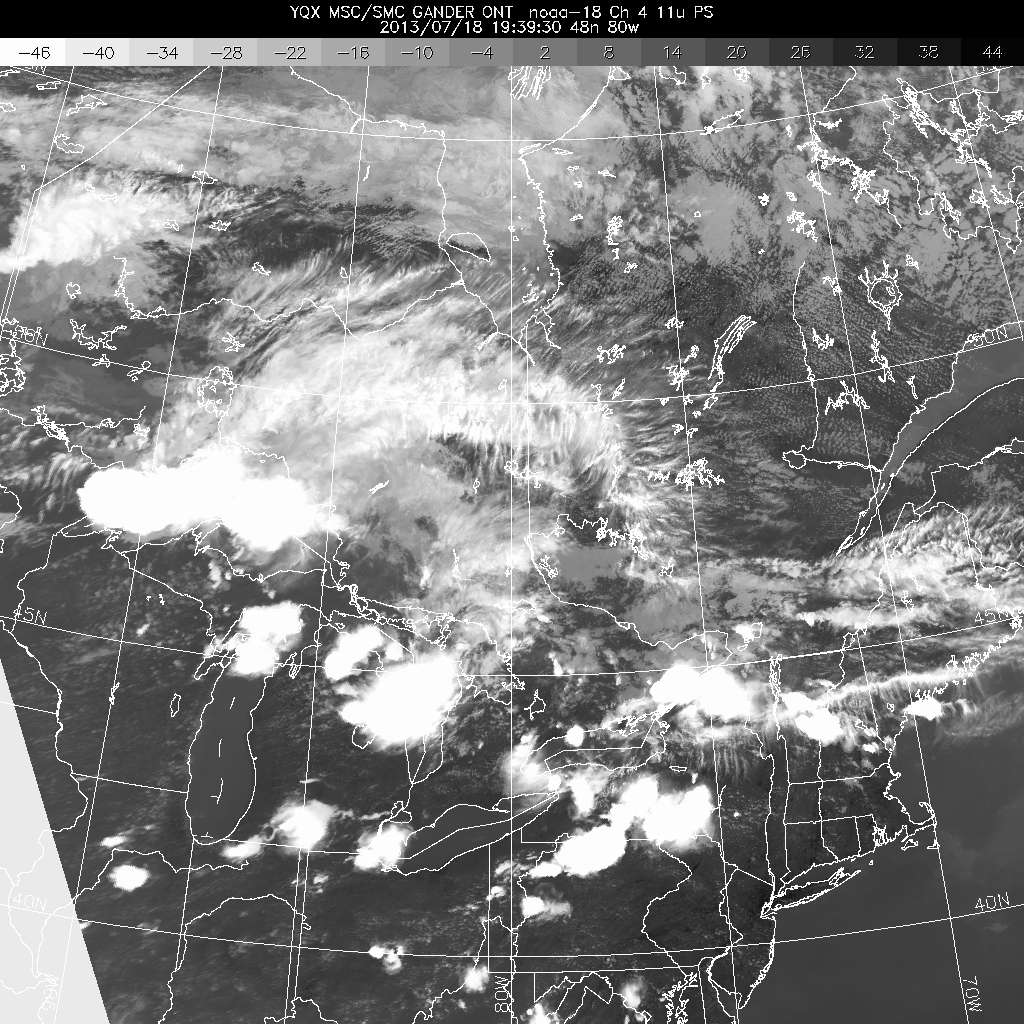
Pictured: NOAA (National Oceanic and Atmospheric Administration) satellite image 9:39 p.m.
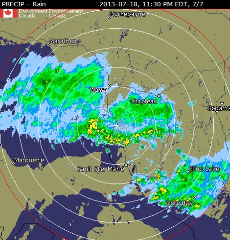
Severe thunderstorm warning for: Sault Ste. Marie - St. Joseph Island continued
At 9:35 p.m. EDT, meteorologists are tracking an area of severe thunderstorms extending from Sault Ste. Marie to Elliot Lake and moving east southeast capable of producing large hail, damaging winds and locally heavy downpours.
Emergency Management Ontario recommends that you take cover immediately, if threatening weather approaches.
Updated or ended by 10:50 p.m. EDT.
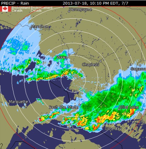
Severe thunderstorm warning for: Searchmont - Montreal River Harbour - Batchawana Bay continued
At 9:35 p.m. EDT, meteorologists are tracking an area of severe thunderstorms extending from Sault Ste. Marie to Elliot Lake and moving east southeast capable of producing large hail, damaging winds and locally heavy downpours.
Emergency Management Ontario recommends that you take cover immediately, if threatening weather approaches.
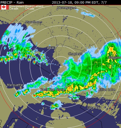
Update: Radar image picture above issued at 9 p.m.
Severe thunderstorm warning for: Sault Ste. Marie - St. Joseph Island issued
At 8:20 p.m. EDT, meteorologists are tracking an area of severe thunderstorms extending from Ranger Lake west through Whitefish Point and mogin east southeast capable of producing hail, strong winds and locally heavy downpours.
Updated or ended by 10 p.m. EDT.
At 8:20 p.m. EDT, meteorologists are tracking an area of severe thunderstorms extending from Ranger Lake west through Whitefish Point and mogin east southeast capable of producing hail, strong winds and locally heavy downpours.
Updated or ended by 10 p.m. EDT.
*************************